Last updated July 21, 2026
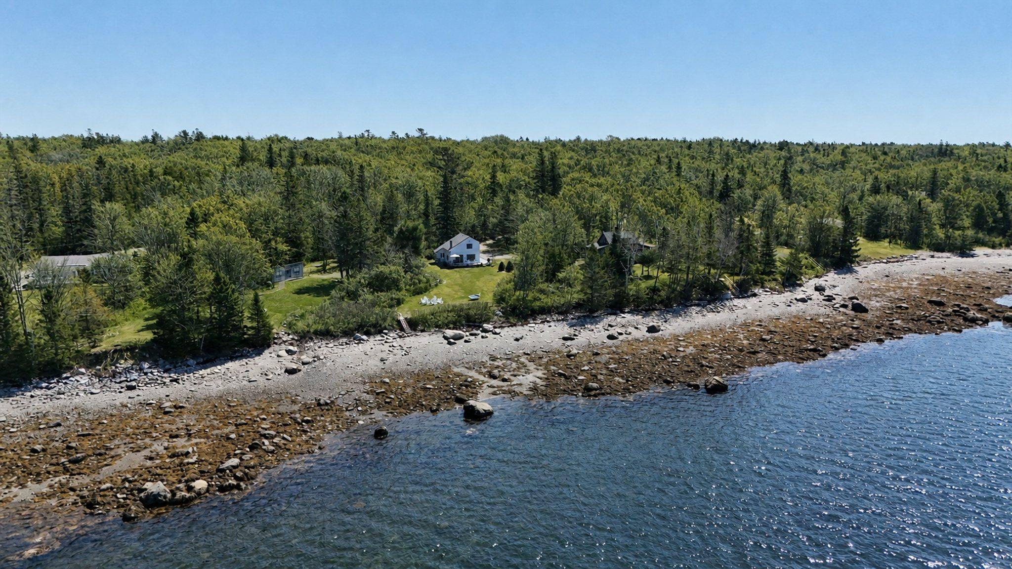
Eagles Nest earns its perch: it sits on Smiths Ledge, the stretch of Trenton shoreline that gives the house its outlook over Union River Bay.
A documented piece of coast
Smiths Ledge isn't a marketing name. It's a mapped coastal feature, surveyed by the State of Maine.
From the record
The State of Maine mapped this shore at 1:4,800.
In 2023 the Maine Geological Survey published a coastal sand dune geology map of Smiths Ledge — the surficial geology, shore features, channels and wetlands of this exact stretch of Trenton shoreline, drawn over an aerial photo base. It is a public record, free to read, and it is the ground the house stands on.
Slovinsky, Peter A., and Dickson, Stephen M., 2023, Coastal sand dune geology: Smiths Ledge, Trenton, Maine: Maine Geological Survey, Open-File Map 23-386, aerial photo, scale 1:4,800. Maine Geological Survey Maps, 2546. Public domain (No Copyright – United States).
View the original map →Why it matters for your stay
Practically, it means the ground under the house is a genuine, surveyed piece of the Maine coast — a ledge shoulder above the tide line, with the bay opening out below and the rocky shore reachable by the stairs. It's the reason the view sits the way it does, and the reason low tide uncovers what it does just past the yard.
We'll be honest about the rest: beyond the geology on the record, we don't claim a documented human history for the name, so we won't invent one. What we can promise is the setting itself — the ledge, the water, and the quiet.
Common questions
What is Smiths Ledge?
Smiths Ledge is the stretch of Trenton shoreline that Eagles Nest sits on, the ledge that gives the house its outlook over Union River Bay. It is not a marketing name but a mapped coastal feature surveyed by the State of Maine. The house stands on a ledge shoulder above the tide line, with the bay opening out below.
Is there an official map or record of Smiths Ledge?
Yes. In 2023 the Maine Geological Survey published a coastal sand dune geology map of Smiths Ledge, drawn at a scale of 1:4,800 over an aerial photo base. It maps the surficial geology, shore features, channels, and wetlands of this exact stretch of Trenton shoreline. The map is a public record, free to read, and released into the public domain as Open-File Map 23-386 by Peter A. Slovinsky and Stephen M. Dickson.
What is the shoreline at Smiths Ledge like?
The shoreline at Smiths Ledge is a ledge shoulder above the tide line, with the bay opening out below and the rocky shore reachable by the stairs. Low tide uncovers more of the shore just past the yard. Beyond the geology on the record, no documented human history is claimed for the name, so the setting itself is what the house offers: the ledge, the water, and the quiet.